
Review · CAPE VERDE
Santiago: Longueira, Pico de Antónia & Monte Tchota Trek
Pico de Antónia is Santiago’s high point, and reaching it is the main event here. The route gives you more than a summit photo: you pass through Longueira village, visit a small grogue distillery, and walk through mountain country where endemic plants and rare birds may appear.
I like the mix of local contact and serious hiking. Meeting people at the village school and Lemba Lemba Bar feels more grounded than simply driving to a viewpoint, while the views toward Fogo Island and Maio Island give the long climb a clear reward. The drawback is just as clear: this is a difficult trek, with steep, narrow, slippery sections and as much as six hours on foot.
Key points to know before booking
- Pico de Antónia reaches about 1,394 meters: You get Santiago’s highest walking point and wide views over the São Jorge Valley.
- Longueira adds real local contact: The stop includes a grogue distillery, primary school, and Lemba Lemba Bar.
- The route is physically demanding: One option covers about 9 kilometers, with roughly 1,050 meters of ascent and narrow, tilted paths.
- Monte Tchota protects intact nature: Look for endemic plants, animals, and bird species, including birds considered at risk.
- The guides are a major part of the experience: Guides including Ricardo, Djibril, and Admilson Garcia have been praised for their care, local connections, and help on steep ground.
- The $106 price includes useful basics: Hotel transfers from Praia, transportation, a guide, a small picnic, and liability insurance are included.
Why this Santiago trek is more than a mountain walk
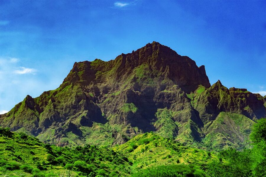
Santiago is often the Cape Verde island where you can best combine daily life, farming villages, and rugged uplands in one outing. This trip uses that variety well. You begin with a drive from Praia, enter village life in Longueira, then leave the settled areas behind for a demanding climb toward Pico de Antónia and Monte Tchota.
I would not choose this as a gentle sightseeing day. The experience is built around physical effort. The details matter: hiking shoes are required, walking sticks are strongly recommended, and the longer route gains about 1,050 meters. The path can be narrow and tilted, and the return may feel harder than expected because slippery ground slows you down.
That said, the effort gives the day a satisfying shape. You are not simply transported to a high lookout. You work your way upward, stop for a small picnic, take in changing views, and finish in a protected natural area. For a fit hiker who wants to see a less urban side of Santiago, this is a strong use of a day.
More treks around the world:
- Mount Etna: Trek to 3000m with cable car and 4×4
★ 4.6 · 3,823 reviews - Bali: Mount Batur Sunrise Trek With Guide and Breakfast
★ 4.8 · 3,461 reviews - From Chania: Full-Day Samaria Gorge Trek Excursion & Guide
★ 4.6 · 3,191 reviews
Longueira: grogue, school, and village life
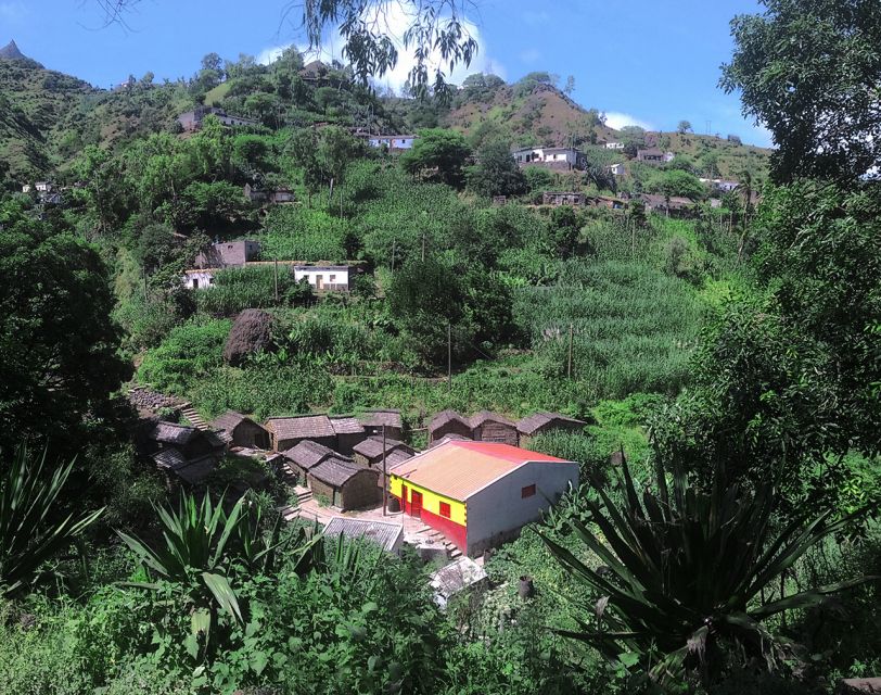
The first major stop is Longueira, where the tour moves beyond scenery and into local life. You visit a grogue distillery, the primary school, and Lemba Lemba Bar. Grogue is Cape Verde’s sugarcane spirit, and the distillery visit gives you a direct connection to one of the country’s best-known local drinks.
I like this opening because it gives the hike a human setting. You see where people live and work before heading into the mountains. The village visit is also a useful reminder that Santiago’s highlands are not empty wilderness. Farms, schools, bars, and distilleries are part of the same world as the trail.
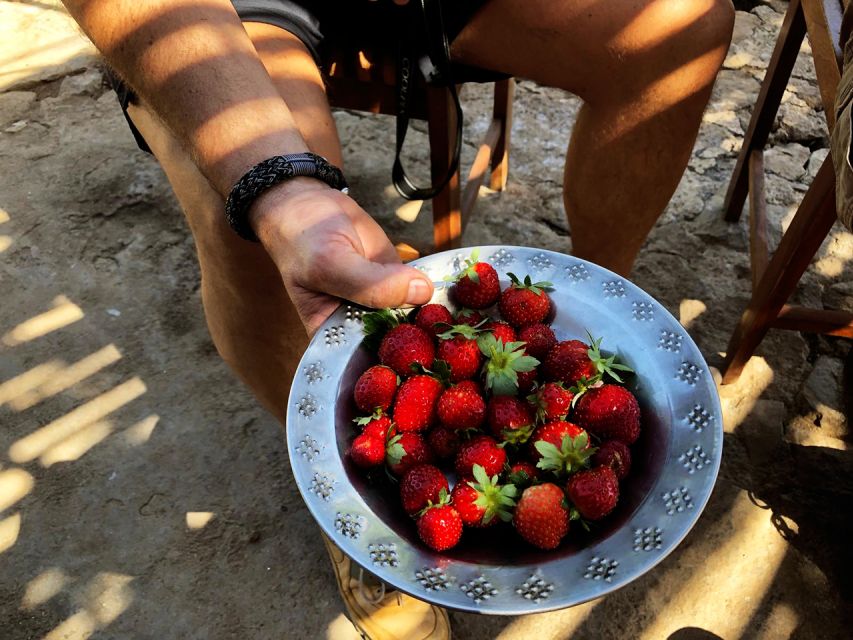
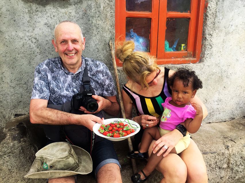
From December to May, the route includes a walk among strawberry fields and a picnic. That seasonal detail is important. The strawberry fields are not presented as a year-round feature, so you should not book this expecting the same stop in every month.
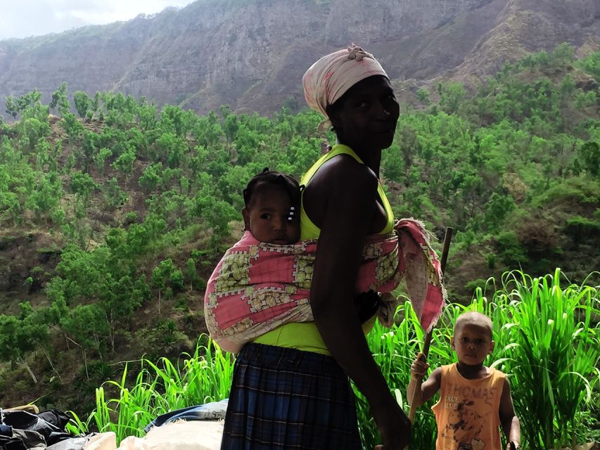
The village section is not a long cultural tour, and it should not be mistaken for one. Its value is in the brief contact and the way it sets the scene. You get a look at ordinary local places, then continue into the countryside with a better sense of the communities connected to these hills.
Climbing Pico de Antónia to 1,394 meters
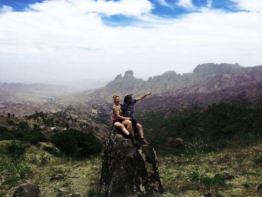
The climb to Pico de Antónia is the physical center of the day. The highest walking point is listed at about 1,394 meters, or 4,573 feet. From up high, you may see across the São Jorge Valley, toward Maio Island, and toward the volcano on Fogo Island.
The views depend on weather and visibility, so I would treat the distant islands as a possibility rather than a promise. Still, the route provides plenty to look at even when haze blocks the far horizon. The changing slopes, valley views, plants, and open mountain spaces give you good reasons to pause.
The climb is not a casual uphill stroll. The longer route covers about 9 kilometers, with around six hours of walking, 1,050 meters of ascent, and 600 meters of descent. Its highest point is about 1,390 meters in the route notes, close to the stated summit height. The path is described as narrow and tilted, so balance matters as much as stamina.
A second route is shorter, about 6 kilometers and four hours of walking. It reaches roughly 1,160 meters, with about 585 meters of ascent and 186 meters of descent. The shorter option is still rated difficult, not easy. Since the route details list two choices, ask which option applies to your booking and fitness level before setting out.
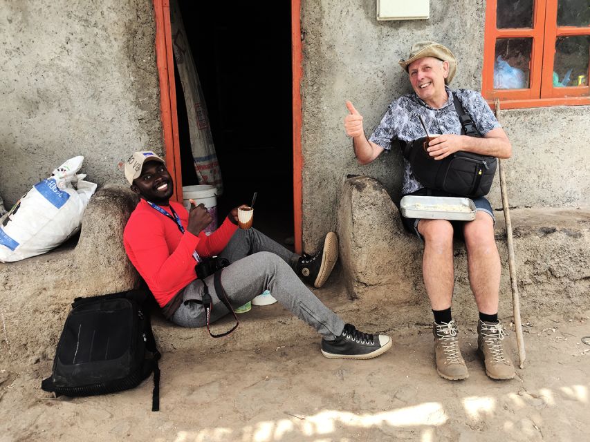
Several people have praised the guides for the way they handle the hard sections. Ricardo has been described as kind and friendly, while Djibril has been praised for being professional, attentive, and respectful. Admilson Garcia has been noted for knowing the area well and for recognizing many people along the route. These details matter because a good mountain guide does more than point toward the summit. On steep or slippery ground, calm pacing and practical help can make the difference.
The picnic and the value of a pause
A small picnic is included, with a sandwich, fruit, and soft juice. It is simple, but that is appropriate for a strenuous walking day. You need a break, and eating something at a scenic point is part of the rhythm of the trek.
Do not treat the included picnic as a full meal. Bring water, and consider carrying an extra snack if you normally eat more during long hikes. The tour specifically advises a hat, sunscreen, hiking shoes, and water. Walking sticks are strongly recommended, and one guide team has provided them during the hike, though I would confirm whether they will be available for your departure.
The picnic also gives you a chance to take photos without rushing. Guides have pointed out good places for pictures along the climb, and the high sections can offer views across Santiago and toward neighboring islands. Keep your camera accessible, but do not let photography distract you from the footing.
Same mountains, a different route up:
- Mount Etna: Summit Crater Trek with Cable Car
★ 4.8 · 1,875 reviews - La Palma: Tajogaite Volcano Guided Trek
★ 4.8 · 1,810 reviews - Etna: summit craters trekking with volcano guide 3350mt
★ 4.7 · 1,712 reviews - From Rethymno: Samaria Gorge Full-Day Trek, Pickup & Guide
★ 4.5 · 1,610 reviews
Monte Tchota and Santiago’s wild side
The trek finishes in Monte Tchota, also written as Monte Txota. This natural park is valued for its relatively intact nature, with native plants, animals, and bird species. Some birds in the area are considered endangered, so the appeal is not only visual. You are walking through a place with real environmental importance.
I would keep expectations sensible. This is not a wildlife-viewing tour with guaranteed sightings, and no particular animal is promised. The best approach is to watch and listen as you walk. You might see endemic plants, small animals, or birds, but the natural setting itself is the reliable part of the experience.
Monte Tchota also provides a fitting finish. After the village visit and the long ascent, the protected upland area feels quieter and more remote. The tour then returns you to Praia by vehicle, with hotel drop-off included.
How hard is the trek in practical terms?
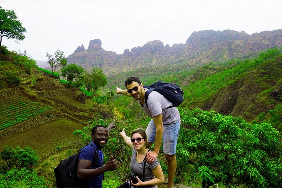
The difficulty ratings deserve your full attention. The longer option is marked very difficult, while the shorter route is marked difficult. The path is narrow and tilted, and the ground can become very slippery on the descent. One account of the walk specifically notes that the return took longer than the climb because of the slippery conditions.
That means you should judge yourself by more than your ability to walk 9 kilometers on a flat road. You need comfort with sustained uphill effort, uneven ground, and a descent that may require careful foot placement. If you are an experienced hiker, the challenge can be rewarding. If you rarely hike, this is probably not the right first mountain route.
Wear proper hiking shoes with secure grip. Hiking pants are especially advised from August through November, when vegetation may make the route less comfortable. A hat and sunscreen are needed because exposed sections can feel intense, and water is essential.
The route is one way rather than a simple loop. Transportation handles the transfers, while your day on foot follows the mountain route between its starting and finishing points. Confirm which route option is planned, since the difference between the two is substantial.
What the $106 price covers
At $106 per person, the cost is reasonable if you value the included transportation and guide service. You get pickup and drop-off at your Praia accommodation, transport to and from the walking areas, a guide, the picnic, and liability insurance. Arranging these pieces separately would take time, especially if you are unfamiliar with Santiago’s mountain routes.
The value is strongest for visitors staying in Praia who want a full day outside the capital without managing transport themselves. The guide is also important on a route with narrow paths, steep sections, and changing trail conditions. Local guides can point out plants, village details, photo spots, and routes that are not obvious from a map.
The price is less attractive if you want a short, easy walk or if you are not prepared for the physical demands. You are paying for a serious trek, not a simple lookout excursion. The small picnic is useful, but it is not the main reason to book.
Shared group departures require at least two participants. If that minimum is not met, the operator may offer another date, charge an additional fee for a private departure, or cancel with a full refund. Keep that condition in mind when planning around a tight schedule.
Who should book this experience?
I would recommend it to experienced hikers and reasonably fit visitors who want to combine Santiago’s people, farms, mountains, and protected nature. It suits you if a steep climb feels like part of the reward rather than an obstacle.
It is also a good choice if you want more than a standard city tour. Longueira gives you contact with local places, while Pico de Antónia and Monte Tchota show Santiago from a higher and quieter angle. The guide support adds confidence on terrain where a solo visitor might lose time or choose the wrong line.
I would hesitate to recommend it to anyone with limited hiking experience, poor footwear, or a strong dislike of slippery descents. The phrase very difficult is not decorative here. Even the shorter option remains difficult, and the full route can take about six hours of walking.
The experience is offered in English, Spanish, French, and Portuguese. That makes it easier to match the tour with your preferred language, though you should select or confirm the language when booking.
My verdict: a rewarding challenge, not a soft adventure
I like this trip because it joins three different sides of Santiago: village life in Longueira, the high summit of Pico de Antónia, and the protected nature of Monte Tchota. The distant views toward Fogo and Maio are a fine bonus, while the local guides add practical help and a personal connection to the area.
Book it if you are ready for steep, narrow, and sometimes slippery trails. Wear serious hiking shoes, carry water, use walking sticks, and ask about the shorter or longer route before you commit. If you want an easy day with little exertion, choose something else. If you want to earn your mountain views, this is one of Santiago’s more memorable day trips.
FAQ
Where does the trek begin?
The tour begins with pickup at your accommodation in Praia, followed by transportation to the village of Longueira.
What places do you visit in Longueira?
You visit a local grogue distillery, the primary school, and Lemba Lemba Bar. From December to May, the route also includes a walk among strawberry fields.
How high is Pico de Antónia?
The walking point reaches about 1,394 meters, or 4,573 feet. The route information lists a maximum elevation of about 1,390 meters for the longer option.
How long does the trek take?
The longer route covers about 9 kilometers and takes roughly six hours of walking. A shorter option covers about 6 kilometers and takes about four hours.
How difficult is the hike?
The longer option is rated very difficult, and the shorter option is rated difficult. Both routes include narrow, tilted paths, with significant uphill walking.
What should I wear and bring?
You must wear hiking shoes. Bring a hat, sunscreen, and water. Hiking pants are strongly advised from August to November, and walking sticks are highly recommended.
Is food included?
Yes. The picnic includes a sandwich, fruit, and soft juice. You should still bring enough water for the hike.
Can you see Fogo Island and Maio Island?
You may see Maio Island and the volcano on Fogo Island from the higher points, depending on visibility and weather conditions.
Is hotel transportation included?
Yes. Pickup and drop-off at your accommodation in Praia, transportation, a guide, and liability insurance are included.
New treks around the world
- Sapa: 2-Day Local Guided Valley Trek with Night Homestay★ 5.0 · 27 reviews
- Sapa: 2-Day Local Guided Valley Trek with Night Homestay★ 4.8 · 5 reviews
- SAPA: 1-DAY TREKKING TOUR WITH LOCALS, LUNCH & RICE FIELDS★ 4.7 · 18 reviews
- Santa Marta: Trekking in Minca Complete Waterfall Circuit★ 4.4 · 28 reviews
- Santiago: Trek from Serra Malagueta to Rabelados Community★ 5.0 · 16 reviews
- Santiago Island: Serra Malagueta & Tarrafal Beach Trek Tour★ 4.8 · 61 reviews
- Santa Marta: Multi-Day Trek to The Lost City★ 4.8 · 40 reviews
- San Pedro de Atacama: Desert Tour with Canyoning & Trekking★ 5.0 · 13 reviews